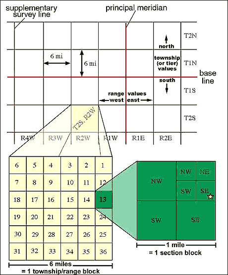
Also referred to PLSS maps, these maps are used by using meridian and base lines to find a location. They are used to divide up the land in the United States, and to subdivide and describe land publicly held in the United States.
Source: http://geology.isu.edu/geostac/Field_Exercise/topomaps/plss.htm
No comments:
Post a Comment